


The Government of the Cook Islands is proud to acknowledge the significant advancements made by Emergency Management Cook Islands (EMCI) of the Office of the Prime Minister (OPM) in strengthening disaster resilience through the successful completion of a series of comprehensive field missions to the Pa Enua, concluding most recently in Aitutaki, and the international recognition of EMCI’s innovative work in geographic information systems (GIS) through the GeoPortal Mapping project.
Supported by the New Zealand National Emergency Management Agency (NEMA) and in partnership with local stakeholders, EMCI has recently completed a two-week deployment in Aitutaki as part of its national programme to build resilience, enhance emergency response capacity, and improve data-driven decision-making in the face of natural hazards.
EMCI’s most recent mission to Aitutaki brings to a close similar missions that have been undertaken across almost every island in the Pa Enua, with Mangaia scheduled for October this year, followed by Nassau and Rarotonga. This mission is part of an ambitious and systematic approach to strengthening national preparedness.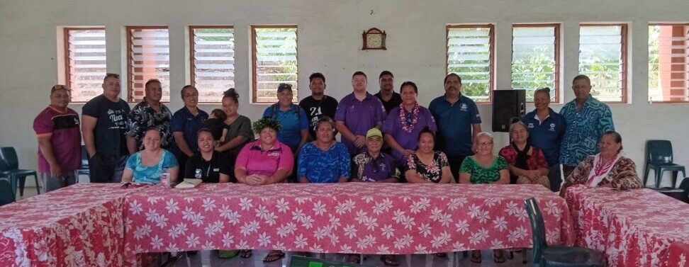 Karopaerangi Ngatoko, Chief of Staff of the Office of the Prime Minister noted that “GeoPortal Mapping is a crucial tool for disaster preparedness because it provides centralised, real-time access to geographic information that supports faster, more informed decision-making before, during, and after emergencies. By visually integrating hazard forecasting with infrastructure data, population dispersal and location of natural resources, emergency responders and planners can anticipate risks, allocate resources more effectively, and better coordinate response efforts across agencies.”
“As we draw nearer to the completion of our GeoPortal Mapping project, I wish to commend the significant undertaking of our EMCI team towards enhancing national disaster preparedness and resilience. The GeoPortal Mapping project also has wider applications beyond disaster planning and response, and I look forward to working collaboratively with line agencies to support broader infrastructure and social development initiatives that would benefit from data-informed policy development, as appropriate.”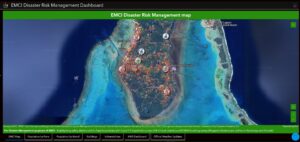
As an example of the wider benefits of the methodology applied throughout the GeoPortal Mapping project, key outcomes from the Aitutaki mission included:
- Emergency Operations Centre (EOC) Training: Providing hands-on capacity-building for local officials and emergency personnel to ensure coordinated response efforts during major events.
- Review of the Aitutaki Island Disaster Risk Management Plan: Ensuring plans are up to date, relevant, and reflective of Aitutaki’s evolving risk environment and community needs.
- School Evacuation Drills: Facilitating practical, real-time evacuation exercises across Araura Primary, Tekaaroa, and Vaitau Primary Schools to familiarise staff and students with cyclone preparedness protocols.
- Comprehensive Building and Population Survey: Mapping 1,468 structures across Aitutaki, including on the motus, and collecting granular data on building type, construction materials, foundation heights, water tank accessibility, household demographics, disability indicators, and utility access. This survey also mapped all critical infrastructure including ports, fuel depots, and power assets, providing an unprecedented data asset for island planning and emergency response.
- Surveyor Training: Empowering local residents with skills to conduct initial damage assessments, which will play a critical role in post-disaster recovery and aid coordination.
The data collected through field missions is hosted privately on the EMCI GeoPortal, with strict controls around access and utility, but with the ability to inform disaster response planning, enhance early warning systems, and support real-time response coordination. The GeoPortal is already being used by island councils to refine evacuation planning, identify safe shelters, and support broader infrastructure and social development initiatives.
International recognition for innovation and impact
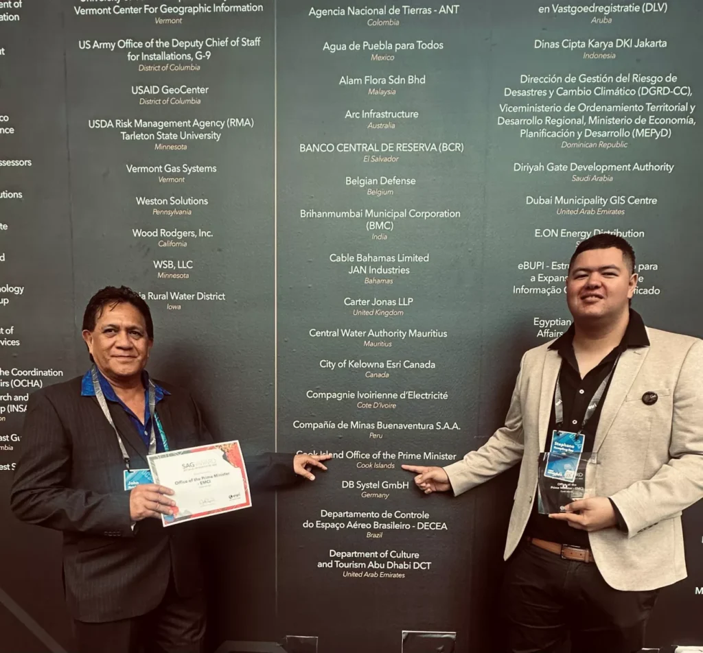
In July 2024, the Cook Islands received international acclaim when EMCI was awarded the Special Achievement in GIS (SAG) Award at the Esri User Conference in San Diego, California. Out of 154 nations represented at the Conference, the Cook Islands was one of only two Pacific representatives, alongside New Zealand, and the first Pacific Island Country outside New Zealand to ever receive this recognition.
This prestigious award acknowledges EMCI’s leadership in deploying GIS technologies for disaster risk management through its national Dashboard. The EMCI Dashboard brings together real-time data feeds, risk maps, population vulnerability indexes, and emergency alerts to provide Cabinet, emergency responders, and community leaders with the tools they need to make informed, rapid decisions during crises.
A whole-of-system approach to national resilience
The Aitutaki mission forms part of a wider national strategy that includes ongoing surveys in other Pa Enua, with Mangaia scheduled for October 2025, followed by Rarotonga and Nassau. The Cook Islands’ emergency management system has also been stress-tested through national simulations like Exercise Uriia Turanga Toru – a Category 3 cyclone response drill co-led by EMCI, NEMA, and UNEP last year.
Prime Minister Mark Brown welcomed the results of EMCI’s GeoPortal Project and the global recognition of EMCI’s work:
“Our nation is no stranger to the forces of nature, but we are determined to meet these challenges with innovation, unity, and decision-making supported by robust data. The work of EMCI across our Pa Enua, and the prestigious recognition of their work at the global Esri conference, reflects our unwavering commitment to safeguarding our people and our future”.
“Ultimately, the GeoPortal Mapping project is more than a disaster management tool, it’s a national asset that strengthens resilience, supports sustainable development, and empowers communities across the Cook Islands. This is resilience in action: Pacific-led, data-informed, and community-driven”.
The Government acknowledges the leadership of the all Island Governments that have participated in the broader EMCI GeoPortal Mapping project, the contributions of local surveyors, and the generous support of NEMA and the New Zealand Ministry of Foreign Affairs and Trade (MFAT) in advancing this critical resilience programme.
As the Cook Islands continues to modernise its emergency management systems and build climate resilience, the EMCI model offers a compelling example of Pacific innovation with global relevance.